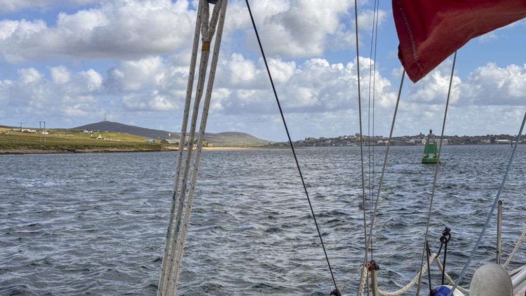
A brief kink in a front offered a chance to escape the dubious shelter of Baltasound, which despite the wonderful hospitality of Unst Boating Club I was very excited to escape. Trilleen and I had a storming passage upwind in 20+ knots to Lerwick, shaving the edge of Fetlar and navigating the narrow passages in the Out Skerries.
0300 starts are a fact of life in sailing. This one was necessary not so much because of tide, but to make sure that I made the best of the wind window, and had time to work out how in all the earth to extract myself from the pier and get my nose out beyond the fat fish farm vessel ahead of me. I’d been very grateful to them for acting as a wave break, but now the inappropriately named ‘Sunshine’ was an obstacle. Some creative manoeuvring with warps got me off the wall and hanging off Sunshine, and then I was very grateful to the crew of a neighbouring fishing boat who slipped my lines as I motored away. This was one of those committing departures – not only because of the pier, but because I was pushing away on a very strong downwind and the chances of getting back to shelter if I didn’t love it were not great.

Having made the second reef on the main and unrolled a scrap of jib Trilleen powered away onto a close reach for the fun part of the passage, a romp to Fetlar, a low offlying island laced by a rim of intricate cliffs, that display some of Shetland’s tortured geology in its full glory. We surged past the steep cliffs, able for once to shave the coast because they were on our weather side – and any problems would allow us to bear away downwind or drift off, and then hardened up for a close hauled beat all the way to Lerwick. The speed fell off, as it does to windward, and I made the third reef to stop Trilleen being overpowered.

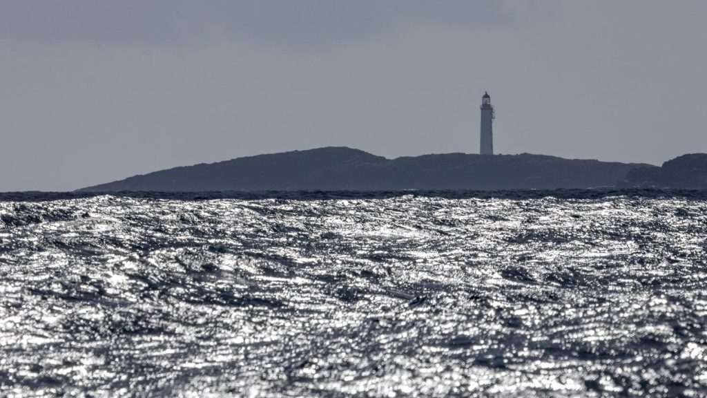
It was critical to avoid losing ground to leeward (downwind) because that would all be hard and painful to make up, so Trilleen and I threaded through the Out Skerries which lie of the east coast of Whalsay, navigating passages down to 2 cables wide at times. Despite the complexity of the navigation, the sailing was gorgeous with Trilleen thundering across a gunmetal sea, each wave crest burnished silver in the slanting light. Outskerries light itself stood out as an indistinct pillar in the hazing spray, towering above the low blue outline of the skerries.
With the sea state becoming more confused I reduced to the second reef and made the Staysail to give Trilleen more chance of driving forward, and she resumed her excellent progress – albeit now with much more water over the deck, and me. I resorted to hiding down below in the warm except for the necessary regular periodic all round look out.
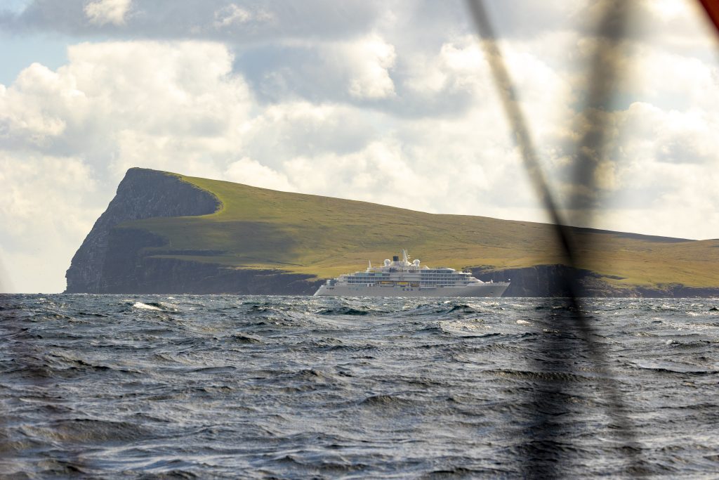
As we neared the vastness of Noss Head with its enormous seabird colony the extremely exclusive cruise ship Silver Endeavour was operating her Gemini dinghies couriering guests out to ‘explore’ the seabird colony. The rapidly changing vectors of the dinghies and the attendant AIS alarms were slowly driving me crazy, until the wind suddenly gusted up 10 knots, at which point the urgent need to reef the boat back down made the annoying beeping a secondary issue.
Shortly after I threw in the tack which took me into the Lerwick Harbour Authority limits and from there Trilleen and I motored in, and began fixing all the things that I’ve broken since I left Stornoway.